'LEJOG'

| Dave Higgins |
Intended start date 18th April 2004.
Wanting a physical and mental challenge, and enjoying hiking & camping, I decided that backpacking from Lands End to John o' Groats would provide both.
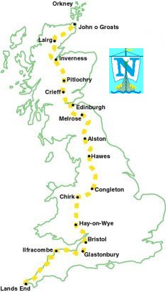
My route, where possible, is 'off road', following convenient National Trails. I have broken the walk into 8 sections to make it mentally easier to manage:
1 Lands End to Minehead along the SW Coastal Path.
2 Minehead to Chepstow via Bristol then along the River Severn.
3 Offa's Dyke Path to Chirk
4 River & canal walks through Cheshire
5 Pennine Way into Scotland
6 The Lowlands footpaths through Melrose, Edinburgh, Crieff,
7 The Highlands through the Cairngorms to Aviemore, Inverness,
8 The Far North through Lairg and finally to John o' Groats.
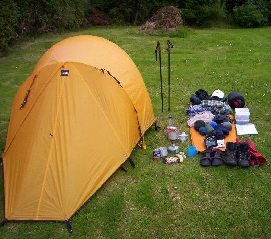
This walk will be unsupported, I will have to carry everything I will possibly need. It is obviously impractical to carry all the Ordnance Survey maps for the whole journey (the maps alone would fill the rucsac !) so I produced strip maps, printed on A4 paper, this does of course mean that if I went off course by more than a couple of miles I would be 'lost' !!
Whilst the walk is purely for pleasure!! I have been encouraged to collect sponsorship and opted to do so for the local charity of Age Concern Orkney.