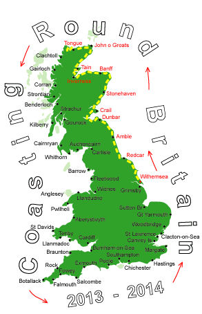
Log No 63. Mon 10th Jun 2013 - North of Daill Farm to Sandwood Bay, 17 miles (1072 miles walked)

| Looking to Port Odhar |
Cape Wrath is MOD land and has and is possibly still used for target practice. There are signs all over warning not to touch suspicious objects.
I was expecting a tough today as it is all cliff walking and with no sheep I will have to rely on the deer to provide the tracks but they can create vertical ones too.
It wasn't long before I started coming across objects, I was obviously in the main target area.

| A target |

| A flare? |

| A shell |

| Looking to Kearvaig Bothy |
The sight of Kearvaig Bothy tempted me to walk straight to it instead of heading back to the cliffs.

| Dave outside the Bothy |
They were regular visitors to the Bothy having been coming here for 20+ years.

| Cape Wrath lighthouse |
I had read that there was a cafe of sorts here but it was nothing like I expected. Inside the building there is a hatch to order drinks and sandwiches then you can stand inside or sit outside.
A minibus full of visitors had just arrived and I didn't feel like spending £1.80 on a mug of tea so I carried on walking.

| Looking over Bay of Keisgaig |
It had been up and down all day and in the constant sunshine the uphills were becoming very slow. At least it was short grass and not heather and far better to have sunshine than rain.
At the Bay of Keisgaig a fence marked the end of the MOD area and I was back in sheep territory.

| Looking to Sandwood Bay |
I saw a stoat dash into the rocks on the path just ahead of me.
Coming off the final hill I could see the bay, the tide wasn't out far enough to clear some of the cliff so I stayed inland a bit, crossed the first stream then found somewhere to pitch the tent at 17.45.

| Sunset over Sandwood Bay |
I had a late night and watched the sun set at 10.24.