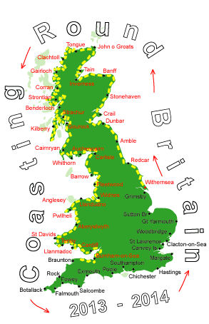
Log No 250. Wed 19th Feb 2014 - Porlock to Lynton, 14 miles (3799 miles walked)
The A39 road between Minehead and Lynton has some very steep sections, Porlock Hill is 1 in 4 with a 1 in 3 hairpin bend while the straight down into Lynmouth is 1 in 5 with an escape road.I had driven the camper up Porlock Hill 8 years ago and it only just managed to get up, I wasn't taking any chances on it not getting up this time so I had driven round to Lynton by the B roads over Exmoor. These only had 1 in 6 gradients.

| Dave coming into Porlock Weir |
The only feasible way for us was to leave the camper in Lynton and get a taxi back to Porlock, it cost £20 but it did mean we were able to start walking by 09.45.
Porlock had a phone signal so I finally managed to update the website while walking along the road to Porlock Weir.

| Culbone Church |
We more or less had the woods to ourselves, the only people we met were looking round Culbone Church.

| Dave on the footpath in Glenthorne |
The footpath was good and dry but there were a few steep sections at the stream crossings to make sure we didn't have it too easy.

| Mick on footpath to Foreland Point |
The weather and the sea were quite calm and it was very peaceful with the only noises coming from the birds and the sea rippling on the pebbles.

| The footpath to Lynton |

| Lynmouth |
Lynmouth is on the East Lyn River and has seen serious flooding in the past while Lynton is built up on the side of the hill on the west side of West Lyn River.

| Lynton Cliff Railway |
The path took half an hour to get to the top and we eventually got back to the camper at 15.45, it had taken us 6 hours to do the 14 miles but it was a very enjoyable walk.